Jhuran Fm
Type Locality and Naming
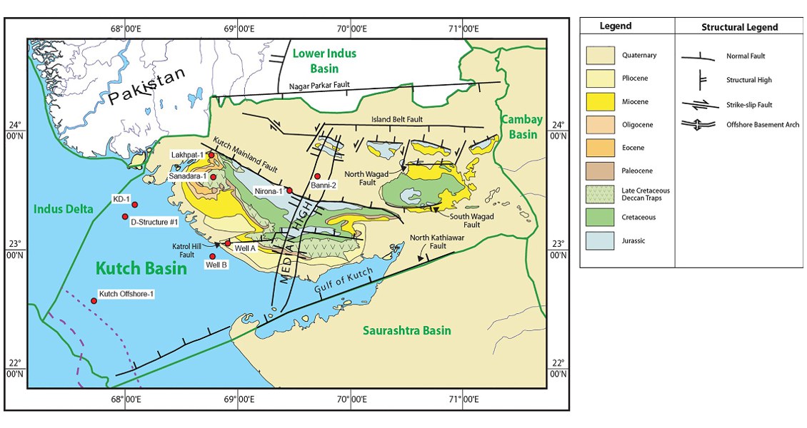
Type section along the stream flowing by the side of ruined Jhuran village, Roha Hills. The Katesar member is exposed only in western Kutch (Biswas, 1977). In the type area thick varies from 348 to 800 m. In the drilled wells onshore it varies from 83 m in Nirona-1 to 553 m in Sanadhra well. In the offshore well GK-29-A-1 the thick is 529 m.
[Fig. Geological and structural map of Kutch, also showing the onshore and offshore wells drilled for oil exploration. (Map by Rasoul Sorkhabi in GeoExpro Dec2014, based on various sources including S.K. Biswas, Current Science, 25May2005)]
Lithology and Thickness
Sandstone and Claystone. The formation consists of greenish sandstone, grey shale and calcareous sandstone. The formation is divided into four members in the type area: Lower member shale and thick calcareous sandstone. Middle member comprising grey shale and sandstone. Upper member mainly pink sandstone and minor shale. Uppermost Katesar member comprises of greenish sandstone is exposed in Ghuneri, Mundhan, western Kutch. The equivalent section is Banni Graben consists of conspicuous micaceous sandstone and dark grey shale with carbonaceous matter and plant impressions. In the type area thick varies from 348 to 800 m. In the drilled wells onshore it varies from 83 m in Norona-1 to 553 m in Sanadhra well. In the offshore well GK-29-A-1 the thick is 529 m
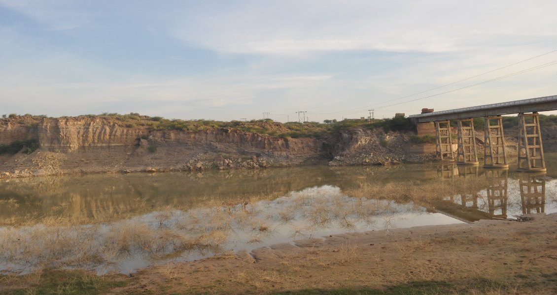
[Fig. Middle (silty sandstone) and Upper ( sandstone) members of the Jhuran Formation are fluvial-deltaic sediments of Late Jurassic age, exposed here on the bank of Khari Nadi (‘River’) in Kutch, about 5 km north of Bhuj. (Source: Rasoul Sorkhabi in GeoExpro Dec2014)]
Relationships and Distribution
Lower contact
Unconformable onto Jumara Fm (its uppermost Dhosa oolitic band)
Upper contact
Gradational with overlying Bhuj Fm. The first appearance of the ironstone band or the topmost calcareous sandstone band is the identification criteria
Regional extent
GeoJSON
Fossils
Ammonites, Lamellibranches, Gastropods, corals, Echinoids, Belmenites sp., and plant fossils are common. The microfauna reported are Lenticulina bulla P.R.Z., Epistomina ventricosa R.Z., and Dorothia kummi- Haplophragmoides pacilis R.Z., etc. (Pandey and Dave, 1993).
Age
Depositional setting
Deltaic to marginal environment. The equivalent section of micaceous and carbonaceous sediments in Banni well is indicative of a very calm environment.
Additional Information

